Satellite Images Expose Extensive Destruction from US-Israel War on Iran
Recent satellite images reveal extensive destruction from the US-Israel conflict with Iran, affecting key military and civilian sites.
Destruction Unveiled by Satellite Imagery
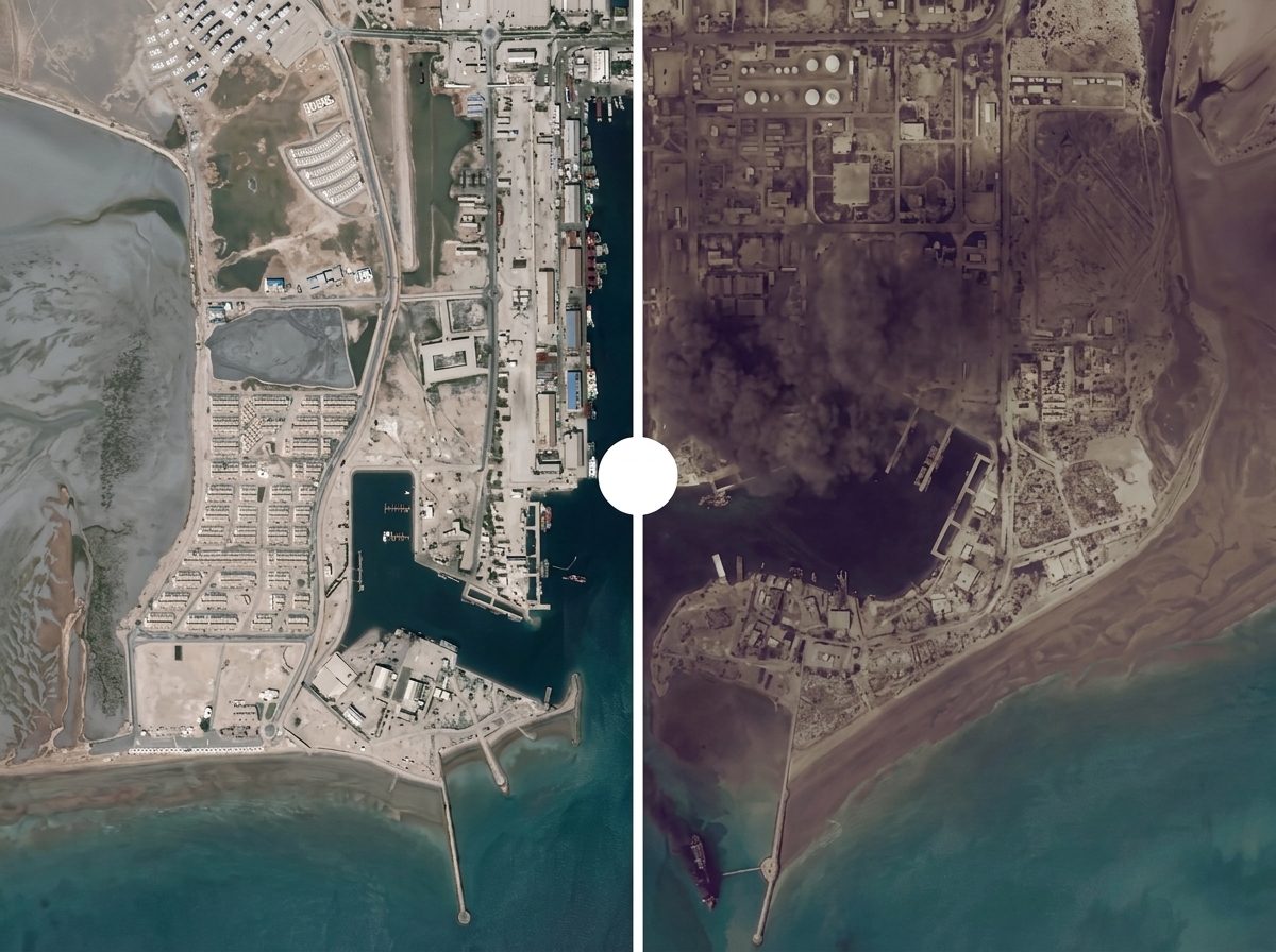
Recent satellite images have exposed the extensive destruction resulting from the ongoing war between the United States and Israel against Iran. This conflict, which commenced over 100 days ago, has wrought havoc not only on Iranian military facilities but also on several important civilian and maritime locations across the region.
Key Sites in Iran Under Attack
Images captured by various satellite companies, including Airbus and Planet Labs, illustrate the devastation inflicted on critical Iranian infrastructure. Among the most severely affected sites is the Natanz nuclear facility in Isfahan, which suffered notable structural damage during strikes carried out in June 2026 as part of Operation Midnight Hammer. The facility, vital for uranium enrichment, experienced direct hits that destroyed access points and operational areas crucial for its function.
Furthermore, the Bandar Abbas port city, a strategic spot near the Strait of Hormuz, has shown extensive damage across multiple locations. Satellite imagery has revealed significant destruction to warehouse structures and vessels docked at the site, caused by air attacks and subsequent fire outbreaks.
Another significant site is Fath Air Base, which serves as a primary operational hub for Iran’s Islamic Revolutionary Guard Corps (IRGC). High-resolution imagery indicates severe damage, including extensive debris and compromised facilities, caused by airstrikes targeting the base.
Impact on Lebanon
The ramifications of the conflict extend into neighboring Lebanon as well. Satellite images have uncovered widespread destruction in Naqoura and Bint Jbeil, towns that have faced relentless bombardment. Over 100 structures in Naqoura have been confirmed destroyed, while Bint Jbeil has seen approximately 725 buildings heavily damaged due to air strikes. This transformation of urban landscapes underscores the devastating consequences of military operations on civilian populations.
Gulf Military Bases Affected
The situation does not stop at Iran and Lebanon, as key US military bases across the Gulf region are also reported to have sustained damage. For instance, at Al Udeid Air Base in Qatar, satellite images show structural impacts from strikes, impacting logistics and operational capacity. Similarly, Ali Al Salem Air Base in Kuwait exhibited signs of damage consistent with missile interceptions, leading to fallout in facilities integral to coalition forces.
The Prince Sultan Air Base in Saudi Arabia recorded damage from missile and drone attacks, with satellite imagery revealing charred tarmacs and structural compromises to vital installations.
Conclusion
The satellite imagery detailing the extensive damage highlights the growing scale of destruction that has unfolded over the past three months of conflict. With ongoing operations and rising tensions, the impact on both military and civilian landscapes paints a grim picture of the region’s future. As restrictions on imagery request are heightened by the US, the full extent of destruction may remain partially obscured from the public eye.
Popular news
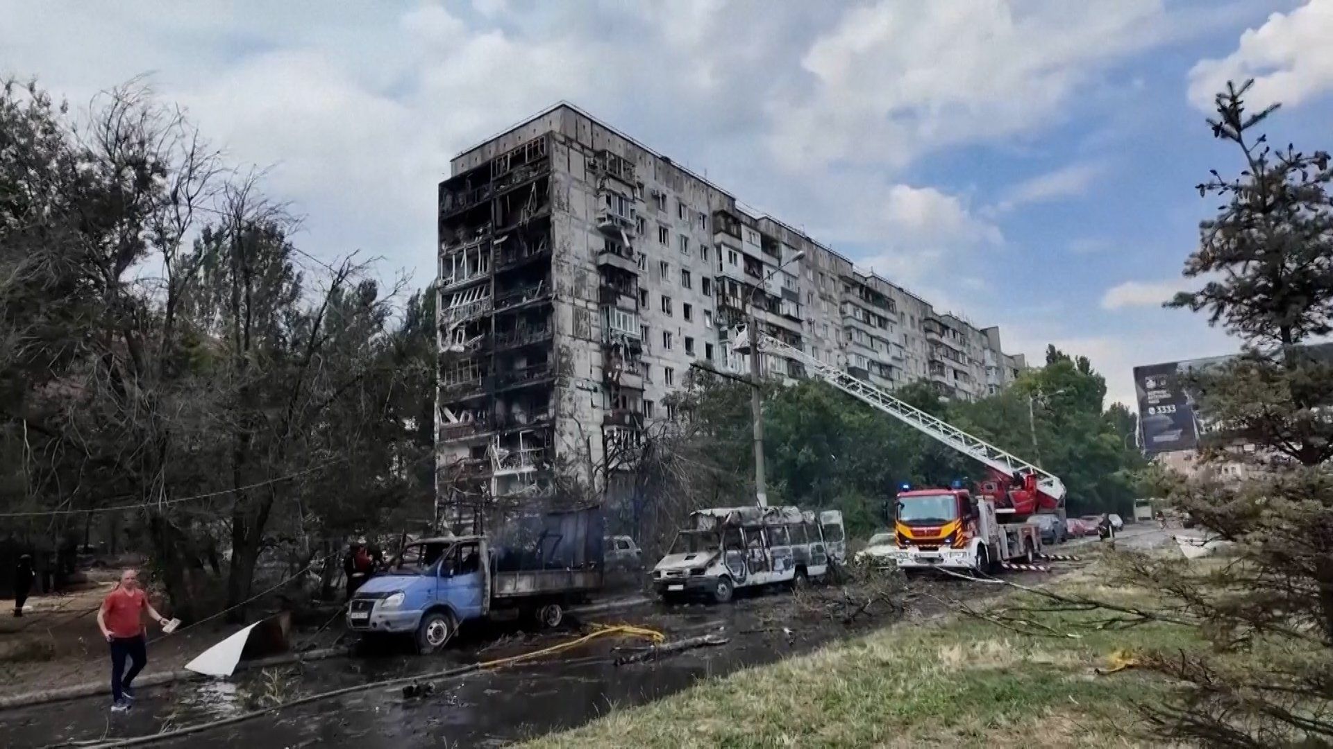
A Russian airstrike in Zaporizhzhia killed three and injured 13, striking residential areas in the ongoing conflict.


Subscribe to
our news
Get the most important updates and top stories in your inbox.
